Nature and Seasons on Koh Yao Noi: Rice Fields, Mangroves and Wildlife
Koh Yao Noi is not wilderness. Almost every hectare you can walk across is used by somebody: paddies that flood and dry, rubber that is tapped before dawn, coconut and cashew, mangrove channels worked by small boats, a coastline with working piers. That is precisely why the island is interesting. The landscape changes because people work it, and the seasons are legible in what the fields and the sea are doing.
This guide describes what is documented, what is seasonal and what remains uncertain. It does not promise a ripe field on a given date, or a hornbill at breakfast.
Two seasons, not four
The island does not have four European seasons. It has a dry season and a rainy season, and the difference between them is less about temperature than about water, wind and what can be done outdoors.
The dry season, broadly from November to April, is generally the easier half of the year for travelling and for anything on the water: calmer seas, more reliable access to beaches and boat trips. It is not a guarantee of clear skies. The landscape looks different too — water levels drop, the paddies and the smaller streams change, and the island is less green than in the wet months.
The rainy season, broadly from May to October, is when the island is at its greenest. It also brings showers and spells of genuinely bad weather, a more variable sea and, occasionally, disruption to power and transport. Rain rarely means a whole day of rain, but planning as if it might is the safer habit.
Neither season is the “right” one. What changes is what you can plan: the dry season makes logistics simpler, the rainy season makes the island more alive and asks for more flexibility.
Reading the island as a working landscape
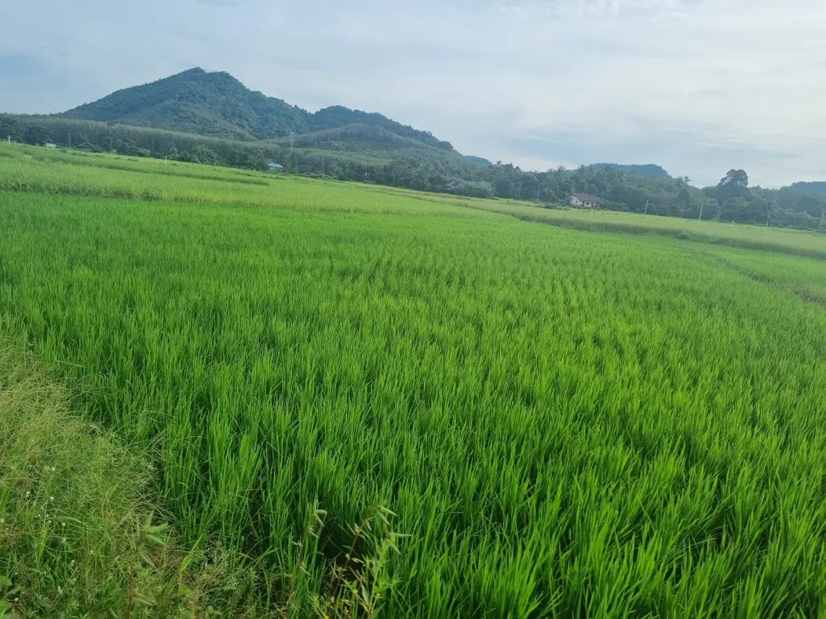
Inland, the centre of the island opens into a patchwork of paddies, forest edges, coconut trees and small local roads: a wet-rice landscape set inside a tropical island, kept recognisably Koh Yao Noi by its hills and forest margins.
Rubber covers much of the rest. It lines roads, climbs hillsides and forms plantations across large parts of the island, and it is not concentrated in one place you can visit, which is why no rubber “trail” is proposed here. Tapping is agricultural work, not an attraction.
Along the coast the character changes again: sandy bays, rocky shore, tidal flats, mangroves and working piers. In the north, the island holds its tallest trees and longest shaded stretches.
The rice year
Koh Yao Noi generally grows one rice crop a year, and the cycle follows the rain rather than a system of several irrigated harvests. Planting happens around June, and the paddies are generally in water from June to November.
The sequence is visible and repeatable. Fields are prepared first, with the soil worked and levelled so water can be held and distributed. Planting happens in more than one way: broadcast across the prepared field, for a more irregular distribution, or in much straighter rows. Once established, the young rice turns the paddies into broad green surfaces, with water often still visible between the plants; as it grows, the fields thicken and the green gradually lightens.
October and November are the best months for the deep green most photographs are taken for. Towards harvest the rice yellows, shifting from pale green to gold. Harvest generally falls in late November or early December, after which the grain is dried in the sun and the paddies become drier and barer. In December and January the plots have usually been harvested, with no standing rice. Timings differ between plots and between years, so an early or late field is normal.
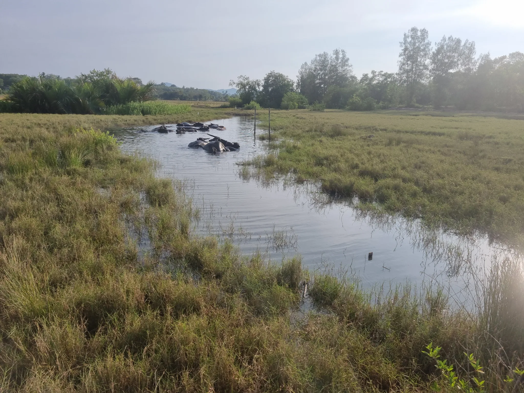
After harvest the fields change use. About a hundred buffalo graze the open paddies outside the growing season; in January to March children fly kites in the evening, usually from around five. A rice festival is usually held after the harvest, in early January, and a scarecrow festival usually in September — check locally for dates.
The working rice landscape is concentrated in the Nam Chuet sector, north of the main village and south of An Pao. Other small plots are scattered through the interior, which is why a drive across the centre of the island still passes fields at different stages.
Rubber, coconut and the wooded interior
Rubber is the island’s quiet economy. The trees are everywhere, the cups and cuts are visible if you look, and the work happens early. Coconut and cashew appear as crops in local government records alongside rice, and orchards and small-scale production shape the rural landscape. What is growing or being harvested depends on the season, so a green field is not a promise of a particular crop or of activity you can watch.
Mangrove, coast and the northern forest
The mangrove walk at Klong Jark connects three environments in a short distance: mangrove, elevated forest and coast. At low tide the mudflats and roots are exposed, which is when you see crabs, mudskippers, herons and kingfishers. Just under 200 steps are involved, most of the route is shaded, and it is not a stroller route. It is the island’s structured mangrove walk; the kayak version explores the channels from the water, where what you see depends on the place, the tide, the time and some luck.
Mangroves also line parts of the west coast and the road towards Long Beach. There is no marked trail there: treat those stretches as working shoreline, look from the road or from the water, and do not push into the mud.
The coastline rewards slow looking. Tha Khao Bay is a wide shallow bay where low tide exposes sand, shells and soft mud, and the rocks at the edges hold crabs and small fish. Rocky shore elsewhere is habitat, not a swimming beach. Offshore, seagrass meadows and algae are part of the coastal system, though they do not explain every change in water clarity.
The seasonal waterfall is interesting mainly from June to November, depending on the rain, and is generally dry afterwards. It is about two minutes on foot from the parking area, and water is never guaranteed.
Rain, wind and the sea
Regional averages for the Phuket area, about 36 km away, give the shape of the year: roughly 67 mm of rain in February, rising through the hot transition of March and April, then 275 mm in May, 320 mm in June, 341 mm in August, 395 mm in September and 354 mm in October. December falls back to about 94 mm. These are historical regional averages, not measurements taken on this island and not a forecast.
The southwest monsoon generally establishes itself around mid-May and brings more wind and rougher seas through October; November to April is generally calmer. That is a seasonal tendency, not a promise about your week. Rain does not necessarily mean all day: showers can be short, but prolonged rain is also possible.
Tide predictions used on this site come from a reference station in Phuket, not from a gauge on Koh Yao Noi, so treat exact heights and times as an indication. Tides decide which beaches are wide, which walks are possible, and when the mangrove roots are visible.
Light at the edges of the day
The east coast faces the sunrise and the west coast the sunset. The sunset guide covers the three piers it recommends — Park Pier, Tha Tondo Pier and An Pao Pier — and how to get back once the light has gone. In the rice fields, the last hour of daylight is what most photographers come for: water in the paddies holds the sky.
Wildlife, and the rules that come with it
The island’s birdlife is the most accessible wildlife. Documented species include egrets, herons, kingfishers, the oriental pied hornbill, brahminy kite, Indochinese roller, greater coucal, olive-backed sunbird, red-wattled lapwing, spotted dove, Asian koel, common myna and Asian openbill, whose presence changes through the year — watch the fields when they hold water. Ducks appear in wet periods.
Mammals and reptiles are present but less often seen: water buffalo and cattle in the fields, water monitors near water, macaques in forest, snakes, wild boar. The macaques are wild and usually discreet, staying in the forest; the one well-known exception is the area around Sawadee Koh Yao. They are not used to visitors, so do not expect to see them, keep your distance if you do, and never feed them.
The rules are short and non-negotiable. Do not feed, touch or corner wildlife. Keep quiet near nests, and move away if an animal changes its behaviour because of you. Give monitors room. If you meet a snake, stop, keep your distance and let it move away — never handle or corner one. Early morning, late afternoon and low tide are the best windows, and every sighting remains a possibility, never a promise.
One honesty note: some photographs on this site are reference images taken elsewhere, not confirmed sightings here, and the page says so where that is the case.
Photographing the island without damaging it
Light is best early and late, when the heat is also bearable; midday flattens the fields. Rice fields photograph well at every stage, but the stage is not something you can order in advance.
No drone rules are published by this guide, and we will not invent them. Ask before flying near people, villages, mosques, piers or working fields, and expect a refusal. Do not stand in planted paddies, and do not photograph people, homes or religious life without asking.
Practical: timing a visit and timing a day
If the rice landscape is the reason for your trip, June to November is the growing season, with October and November usually the greenest; harvest comes in late November or early December, and from December to April the fields are dry and open, with kites and buffalo. If calm sea matters more than green fields, November to April is generally calmer, at the cost of dry paddies.
Within a day: start early, rest during the heat, go out again in the late afternoon. Carry water, wear shoes with grip, use an offline map, and check the tide before a coastal walk.
Where to go next
The rice fields guide goes deeper into the agricultural cycle, and weather and seasons explains the monthly figures and their limits. For wildlife, use birds and wildlife; for the mangrove, the mangrove kayak trip; the walkway at Klong Jark is reached from Klong Jark beach. Tides are in tides, and responsible behaviour in responsible travel.